2021-10-31
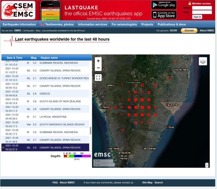
NB: The EMSC-CSEM has since issued clarification that the grid pattern results from the rounding accuracy used to plot the quake location. Thus even though the actual quake may have been at a slightly different point, the point plotted on the map will always be at the nearest grid point determined by the plotting algorithm. We are happy to make this clear.
2021-10-24
Anybody care to explain this plot of quake locations on the island of La Palma?
(source: https://www.emsc-csem.org/Earthquake/Map/gmap.php )